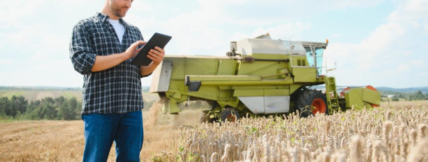
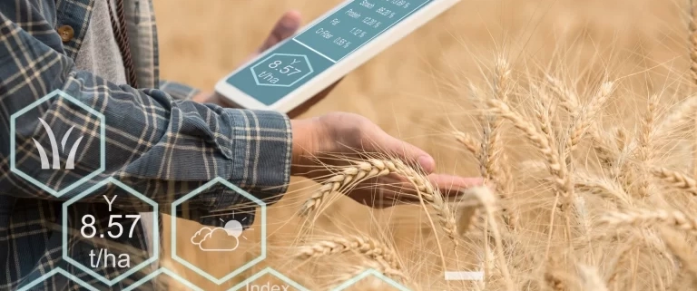
What is plant indexes in satellite imagery?

The use of multispectral satellite imagery for the purposes of monitoring the health and stresses of agricultural products is one of the most important applications of remote sensing. At different stages of growth and with the change in the structure of plants, the reflection of light in plants is different.
For example, some phenomena such as reduced greenness in plants, change in water volume in plants, decrease in surface temperature due to photosynthesis and etc can cause changes in the reflection of light from the plant in one or more invisible or visible bands.
The Satelyzer team uses these factors to detect plant stresses and field monitoring.This information can be used to manage agricultural land, increase productivity and reduce costs, which has a significant advantage over land visits for large farms, especially 50 hectares and above. See a sample of the company’s output for on-farm management advice

NDVI (Normalized Difference Vegetation Index)

NDVI is the most common vegetation index is remote sensing, which simply describes plant growth based on how different light waves are reflected by a plant. It can be used throughout the growing season, except when vegetation is very scarce. This indicator is quite sensitive to soil brightness and weather effects. The best time to use this index is in the middle of the season during the crop growth phase.

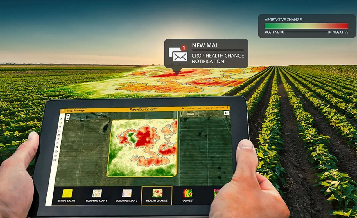
For the convenience of users, Satelyzer Company shows the values ​​of this index with color parameters that green indicates a dense and healthy product and red indicates a low and scattered product or there are problems on the ground with other indicators that will be introduced bellow in this article. By identifying weak areas through the maps provided by Satelyzer, farmers can go to the area and take action to solve the problem.


NDWI (Normalized Difference Water Index)

NDWI is sensitive to changes in the water content of agricultural products. This index is used to identify flooded agricultural lands, identify irrigated agricultural lands and identify wetlands. This index is modeled in blue in the Satelyzer’s  system. As it is clear from this figure, the more blue the image, the more water content of the product and the redder the image, the less water content.

From this figure we conclude that the parts of the field that are red are facing the problem of water shortage. Satelyzer users can irrigate the area by identifying low water areas.

NDRE (Normalized Difference Red Edge Index)

The plant nitrogen index indicates the level of nitrogen absorbed by the plant. The best time to apply the nitrogen index is mid to late growing season, when the plants are mature and ready to harvest. At this point, other indicators will be less effective for use. At this point, NDRE is a much better indicator than NDVI. This is why using the NDRE map for variable rate fertilization, spraying, irrigation, fertilizing and other field activities will be more effective in the later stages of growth. By identifying low-nitrogen spots in a field there will be no need for fertilizing whole field, which results in savings in fertilizer consumption and costs.

LAI (Leaf Area Index)

The LAI index is designed to analyze the leaf area of the field and estimates the amount of leaves in a particular area. This index is important for monitoring crop and forest health, environment and weather conditions.This index is very important for comparing and selecting the best cultivar, especially forage plants that have high leaf area.This index is shown in green and yellow in Satelyzer system. As can be seen in the figure, the areas with a brighter green color have more leaf area and vice versa.

CHL (Chlorophyll Content Index)

The plant chlorophyll index shows the amount of chlorophyll stored in the product. The higher the CHL index, the higher the chlorophyll content of the plant. The Satelyzer system shows this indicator in green and brown. In the picture, it is clear that the greener the map color, the more chlorophyll in the plant, and the more brown it is, the lower the chlorophyll in the plant. High chlorophyll can be a sign of plant growth and increased green area.Perhaps in areas with less chlorophyll, the size of the plant is smaller and the green area is less, in which case further strengthening of these areas will increase the level of chlorophyll in these areas.

What is agricultural soil?

Agricultural soil is a support and housing for the plant as well as a bed to supply minerals and nutrients and a reservoir to supply the water it needs. Although there are alternatives such as water cultivation today, soil-based agriculture is still suitable.

Definition of soil

Soil Science Society of America :

It is a natural mass that is composed of minerals and organic matter and covers most of the earth’s surface and can hold the roots of plants.

Definition from a geological point of view:

The solid and soft part (discontinuous particles) of the upper part of the earth’s crust, which is formed by the destruction and decomposition of minerals and water and the formation of new compounds (clay minerals and soil). This aerated and discontinuous cortex is able to contain animal and plant life.


Soil formation (soil formation) takes place through the following processes

  • Weathering of bedrock and shrinkage of particles of rocks
  • Formation of new minerals
  • Decay and decomposition and increase of organic matter transformations
  •  Formation of inorganic-organic compounds by combining minerals

Soil resources limiting factors in agriculture

These factors are divided into two categories of immutable constraints and modifiable constraints. Immutable constraints are related to soil texture. Modifiable limitations include the presence of rocks and gravel, salinity, alkalinity, drainage, etc., which can be reduced or eliminated by special measures.

The soil texture is derived from the bedrock and it takes many years for the soil to form. Water and wind erosion, improper operation of heavy machinery are among the causes of soil degradation and leaching.


Organic soils

In advanced agriculture, plant residues are used to improve soils with the aim of environmental sustainability and soil protection. Today, experts recommend preserving crop residues from land crops. For example, incineration of grain residues that were common in the past but are now mixed with soil as organic matter and stored in the ground.

These days, we hear about modern agriculture, smart agriculture, precision agriculture, digital agriculture and remote sensing a lot.In this article, we are going to examine these definitions quite simply and mention their advantages and disadvantages.

Nowadays increasing agricultural productivity is felt more essential than ever.The increase in the planet’s population and the reduction of natural resources such as water, soil and energy, are the reasons of using new technologies to improve farmer’s performance and increase the farm efficiency.

Modern agriculture is an ever-changing approach that uses new technologies to allow farmers to increase productivity while reducing environmental impact. These technologies include the use of new satellite imagery and sensors, indoor vertical farming, precision farming, modern machinery and artificial intelligence, and image processing in agriculture.


Precision farming


The definition of precision agriculture is the use of technology for agricultural management that observes, measures, and analyzes the needs of farms and crops. Precision farming allows farmers to use technology to build management systems based on specific data on soil, crops, nutrients, pest moisture or yield. Instead of treating land as a domain, the technology identifies problematic points and reduces the need for overuse or misuse of products.

The main point here is optimization. In precision farming, instead of using an equal amount of fertilizer on a complete farm, farmers only fertilize areas that need fertilizing, the exact location of which is determined by satellite imagery or sensors installed on the farm. This leads to optimal fertilizer use, cost savings and reduced environmental impact.

Smart agriculture


Also, a new way of planting, holding and harvesting crops in the agricultural industry is called smart agriculture, which is based on technology and intelligent processes and human beings are not involved in the beginning or end of those processes.